Smart Real-Time Transit and Subway Traveler Information System for Washington Metropolitan Area Transit Authority (WMATA)
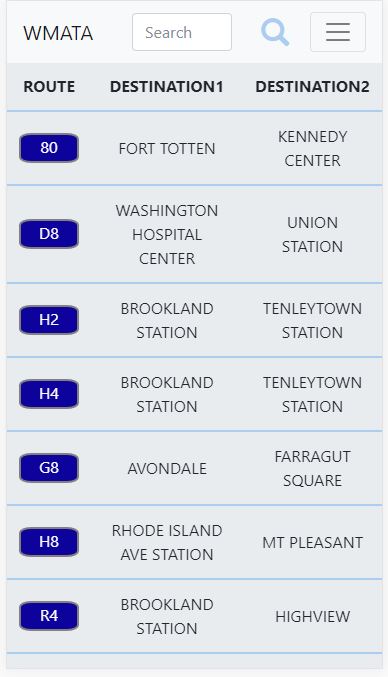
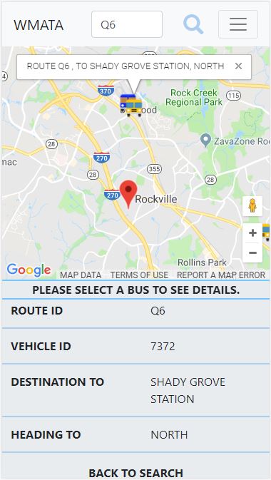
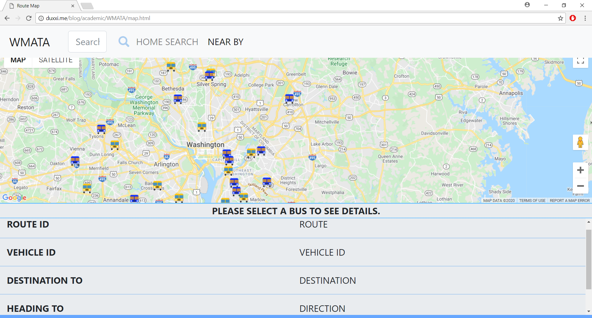
WMATA (https://www.wmata.com/) as a tri-jurisdictional government agency (District of Columbia, Virginia and Maryland) operates transit service in the Washington Metropolitan Area. WMATA transit services include rapid transit service (Metrorail), fixed-route bus service (Metrobus), paratransit service (MetroAccess) and DC Circulator bus system. This project aims to create a cloud service for WMATA transit systems by integrating WMATA API and Google Map API to implement web-based and smartphone-based applications (Web-based, mobile app for ISO and Andriod) for accessing real-time locations of the buses and trains, arrival time at bus and train stations. WMATA provides the project team with routes, schedule, GPS location data and accident information of buses and trains. The project implemented the following functionalities via App (https://cityconnecting-acc76.web.app). 1. Display of Real-Time Locations and Forward Directions of Buses and Trains 2. Recommendation of the Nearest Bus & Trains Stations based on User Location 3. Estimated Arrival Times of Buses & Trains 4. Forecasted Arrival Times of Buses & Trains 5. Integrated Optimal Routing of Buses & Trains